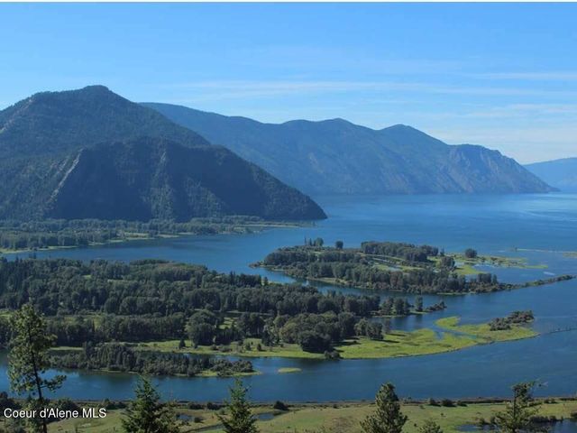
View from Schweitzer Mountain and resort of the towns of Kootenai, Ponderay and Sandpoint, Idaho, along the shores of Lake Pend Oreille
Welcome to

Clark Fork

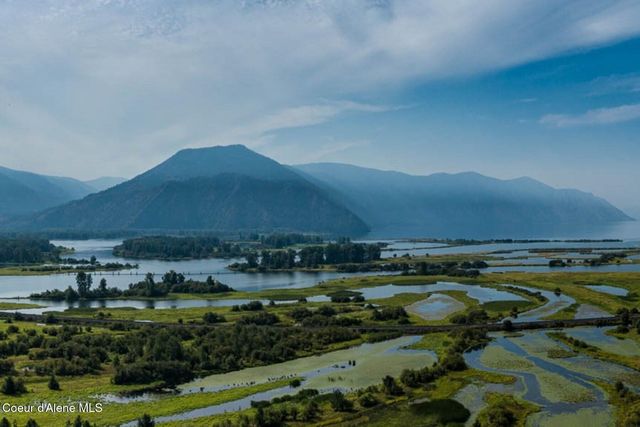
Where the Clark Fork River meets Lake Pend Oreille, under the Scotchman Peaks

town · North Idaho

Reviewed by Tatum Hoehn · October 6, 2026

Explore Clark Fork Real Estate →
513
Population (2020 Census, Clark Fork city)
1,158 ft
Lake Pend Oreille Maximum Depth
~25 miles
Drive to Sandpoint on Highway 200
134
Clark Fork Jr/Sr High Enrollment, Grades 7-12 (2024-25)
117
Hope Elementary Enrollment, PK-6 (2024-25)

Statistics as of June 30, 2025

Local Overview

About Clark Fork

Clark Fork is one of Idaho's smallest incorporated cities — 513 people at the 2020 census — set where the Clark Fork River finishes its long run out of Montana and fans into a broad, braided delta at the east end of Lake Pend Oreille. Highway 200, the Pend Oreille Scenic Byway, doubles as main street: Sandpoint is about 25 miles west along the lakeshore through Hope and East Hope, and the Montana line is just a few minutes east past Cabinet Gorge Dam. The Cabinet Mountains stand over the south side of the valley, and the Scotchman Peaks — the wild core of an 88,000-acre proposed wilderness — rise almost straight off the north edge of town.

The town began in the early 1880s as a siding on the Northern Pacific line that still carries freight along the river today, and for decades a ferry crossed the Clark Fork here before bridges made it unnecessary. That working history shows in the town's character: a compact grid of homes around the school, a hardware store, a pantry-deli, a lodge, and a handful of outfitters and charters covering the essentials, with bigger errands, groceries beyond the basics, and most services handled in Sandpoint. Lake Pend Oreille School District runs Clark Fork Jr/Sr High — home of the Wampus Cats — right in town, with district elementary students attending small Hope Elementary up the highway.

What Clark Fork trades in convenience it returns in setting. The delta below town is the largest contiguous wetland complex on the Pend Oreille system, thick with waterfowl and paddling water; the lake itself is Idaho's deepest at 1,158 feet, a fishery of world-record pedigree; and the trailheads behind town climb into goat country managed as recommended wilderness since 1987. This is a place for people who want hunting, fishing, and backcountry out the door — and who are content to let Sandpoint stay 25 miles away.
Seasonality

Living in Clark Fork Through the Seasons

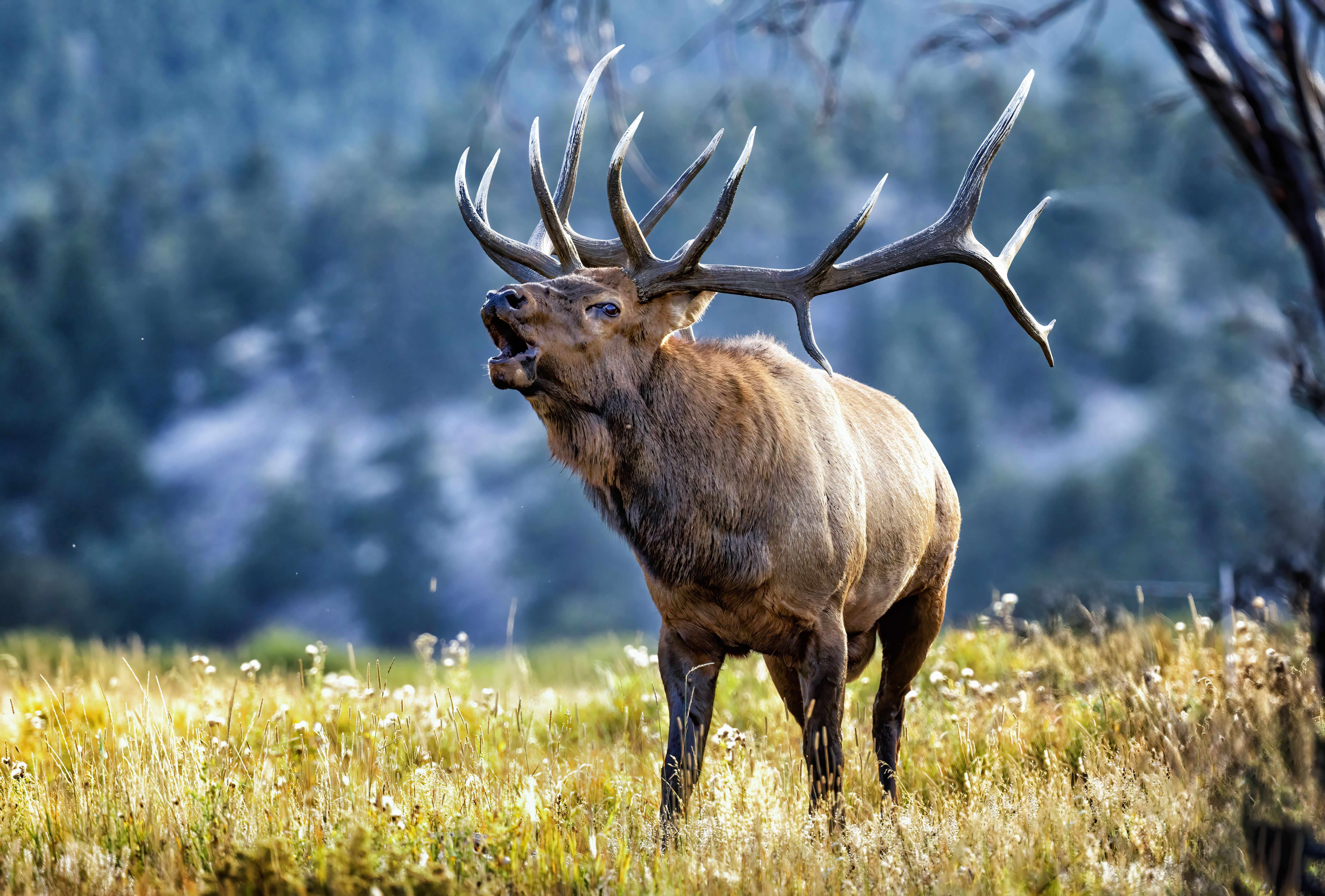
Fall may be the season that defines Clark Fork best. This is an unapologetic hunting and fishing town, and when the larches turn gold on the Cabinet front, rigs head up the Lightning Creek roads and the fall kokanee and trout bites come on. Winter settles in wet and white at the lake's east end: the town sits low, so valley snow comes and goes with warm lake air, while serious snow stacks up fast on the peaks behind it. Schweitzer — Idaho's largest ski area at 2,900 acres — is roughly an hour away via Sandpoint, and residents treat winter driving on Highway 200's lakeshore curves as a skill worth respecting.

Spring is runoff season, when the river that supplies about 80 percent of Lake Pend Oreille's water runs big and the delta floods into a maze of channels — historic accounts put high water at 94,000 cubic feet per second, which is why the old ferry crossings here were famously dicey. Summer flips the town toward the water: Sam Owen and the Hope peninsula fill, the delta becomes glassy morning paddling, and long northern evenings stretch past nine o'clock. Late summer can bring drifting wildfire smoke from regional fires — a North Idaho reality residents plan around rather than pretend away — before the first cold fronts rinse the air and start the cycle again.

Elk bugling in Fall
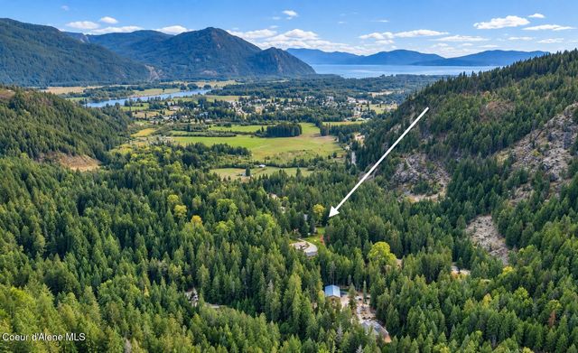
Overlooking Lake Pend Oreille and the highway into Sandpoint, ID
Regional Access

One Highway, One Railroad, and Sandpoint Down the Shore

Everything in and out of Clark Fork moves along Highway 200, the 33-mile Pend Oreille Scenic Byway that follows the lake's north shore from Ponderay to the Montana line. Sandpoint — the county seat and the corridor's service hub — is about 25 miles west, a pretty drive through Hope and East Hope that residents make routinely for groceries, banking, and appointments. Eastbound, the highway passes Cabinet Gorge Dam — an Avista hydro project completed in 1952 at the gorge where the ice dam that impounded Glacial Lake Missoula once stood — and crosses into Montana toward Noxon a few minutes from town. The Northern Pacific-era rail line still runs through Clark Fork as an active freight corridor; the nearest passenger service is Sandpoint's depot, the only Amtrak stop in Idaho, where the Empire Builder calls daily in each direction.

Healthcare planning is straightforward but real: there is no clinic-and-hospital cluster in town, and the region's hospital is Bonner General Health in Sandpoint, a 25-bed critical access hospital with a 24-hour emergency department, backed by larger medical centers and Spokane International Airport about 80 miles beyond Sandpoint in Washington. Households here keep capable vehicles, watch winter forecasts, and build the Sandpoint run into the weekly rhythm — the practical price of living at the quiet end of the lake, and one most residents consider a bargain.

Living Here

Modest In-Town Homes, River Frontage, and Timbered Acreage

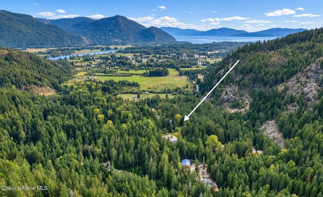
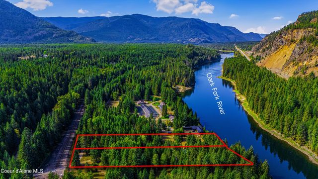
Housing in Clark Fork runs in three broad flavors: modest homes on small in-town lots within walking distance of the school and the highway businesses; river and delta-adjacent parcels along the lower Clark Fork with big water views and serious wildlife traffic; and timbered acreage up Lightning Creek and the surrounding foothills, where driveways get longer and winter access becomes part of the conversation. Because Clark Fork is an incorporated city — rare at this size in Idaho — buyers deal with a city government on in-town questions and Bonner County beyond the limits, and utilities, wells, and septic arrangements genuinely vary parcel to parcel. Waterfront diligence deserves particular care here: the delta has been losing 12 to 15 acres a year to erosion, lake levels move with dam operations, and spring runoff redraws the river's edges — so flood zones, bank condition, and elevation belong on every waterfront buyer's checklist, the same way they're on every local's mental map.

The economy is small-town diversified — agriculture, forestry, small businesses, and tourism built on camping, hunting, and fishing — with Avista's Cabinet Gorge Dam a longtime presence just east and many households commuting to Sandpoint or working remotely on the strength of the setting. The school is the community's anchor, the delta restoration work has brought sustained public investment to the town's front yard, and the proposed Scotchman Peaks wilderness reflects a community that largely wants its backdrop kept wild. People who thrive here tend to arrive clear-eyed about the drive and stay for everything the drive protects.

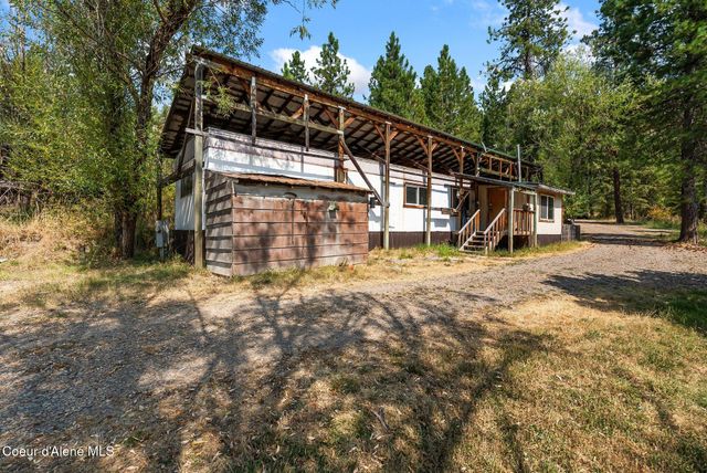
Off-grid cabin in the wilderness
Local Expertise

Talk With a Clark Fork Local

Delta and river frontage, flood zones and bank erosion, Lightning Creek access roads, and city-versus-county rules all change parcel by parcel here. Our agents who know the Highway 200 corridor can give you the current, on-the-ground picture.

Contact an Agent
View from Schweitzer Mountain and resort of the towns of Kootenai, Ponderay and Sandpoint, Idaho, along the shores of Lake Pend Oreille
Sources and review notes

Reviewed by Tatum Hoehn on October 6, 2026.

  1. Census Bureau Profile: Clark Fork city, Idaho (GEOID 160XX00US1614950)U.S. Census Bureau · Accessed August 11, 2026
  2. Census geocoder Places-layer record: Clark Fork city (GEOID 1614950; place FIPS 16-14950; centroid coordinates)U.S. Census Bureau · Accessed August 11, 2026
  3. Clark Fork, Idaho (2020 census population 513; rail and ferry history; economy)Wikipedia · Accessed August 11, 2026
  4. Visit Idaho's Great Lakes for some of the 'best of the best' fishing (Lake Pend Oreille: 43 miles long, 1,158 feet deep, fifth-deepest in the U.S.)Idaho Fish and Game · Accessed August 11, 2026
  5. Clark Fork Delta Restoration (largest contiguous wetland complex in the Pend Oreille system; river supplies about 80% of the lake's inflow)Idaho Fish and Game · Accessed August 11, 2026
  6. Restoring the Clark Fork Delta (12-15 acres lost annually; Phase I construction 2014-2015)Idaho Fish and Game · Accessed August 11, 2026
  7. Why Wilderness (88,000-acre roadless area on the Idaho-Montana line; recommended wilderness since 1987; mountain goats)Friends of Scotchman Peaks Wilderness · Accessed August 11, 2026
  8. Idaho State Highway 200 (33 miles, Ponderay to the Montana border; Pend Oreille Scenic Byway)Wikipedia · Accessed August 11, 2026
  9. Clark Fork Idaho, Your Home on the Clark Fork River (25 miles east of Sandpoint; rail siding origins; local businesses)Sandpoint.com · Accessed August 11, 2026
  10. Common Core of Data school detail: Clark Fork Jr/Sr High School (ID 160000200082), grades 7-12, 2024-25 enrollmentNational Center for Education Statistics · Accessed August 11, 2026
  11. Common Core of Data school detail: Hope Elementary School (ID 160000200614), grades PK-6, 2024-25 enrollmentNational Center for Education Statistics · Accessed August 11, 2026
  12. Cabinet Gorge Dam (completed 1952; Avista; just west of the Montana border)Wikipedia · Accessed August 11, 2026
  13. Cabinet Gorge Dam (Ice Age Floods National Geologic Trail: site of the Glacial Lake Missoula ice dam)National Park Service · Accessed August 11, 2026
  14. Schweitzer (2,900 acres, 92 runs, largest ski resort in Idaho, at Sandpoint)Visit Idaho (Idaho Tourism) · Accessed August 11, 2026
  15. Bonner General Health (25-bed critical access hospital with emergency department, Sandpoint)Bonner General Health · Accessed August 11, 2026
  16. Travel Info (Sandpoint is Idaho's only Amtrak stop; Spokane International Airport about 80 miles from Sandpoint)Visit Sandpoint · Accessed August 11, 2026

Area Guide content is unavailable.